Preventing Roadblocks
PRI Keeps Illinois on the Straight and Narrow
With the help of Prairie Research Institute scientists, transportation agencies are building Illinois roads in compliance with state and federal regulations, while preserving Illinois’ physical, biological, natural, and cultural resources.
Transportation infrastructure is necessary for life and economic vitality in Illinois but can have impacts both locally and downstream for human communities and natural resources. PRI data help the Illinois Department of Transportation and Illinois Tollway do their work to comply with regulations like the National Environmental Policy Act, the Clean Water Act, the National Historic Preservation Act, and the Endangered Species Act. PRI’s work also allows these agencies to avoid the delays and costs of previously unidentified environmental hazards, endangered or protected species, or cultural artifacts.
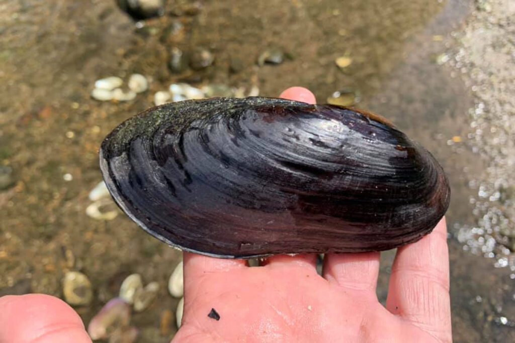
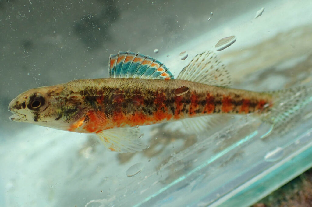
It also expands our understanding of the resources the state seeks to protect and contributes to mitigation and restoration efforts, from the restoration of wetlands and development of forest preserves to a new understanding of the Black Sandshell Mussel and the Iowa Darter, two species that had previously been listed as threatened in Illinois.
“Part of the work that we’ve done with the Illinois Tollway has led to the de-listing of these two species,” said Michael Dreslik, who is an assistant research scientist at the Illinois Natural History Survey (INHS) and leads the Population and Community Ecology Lab.
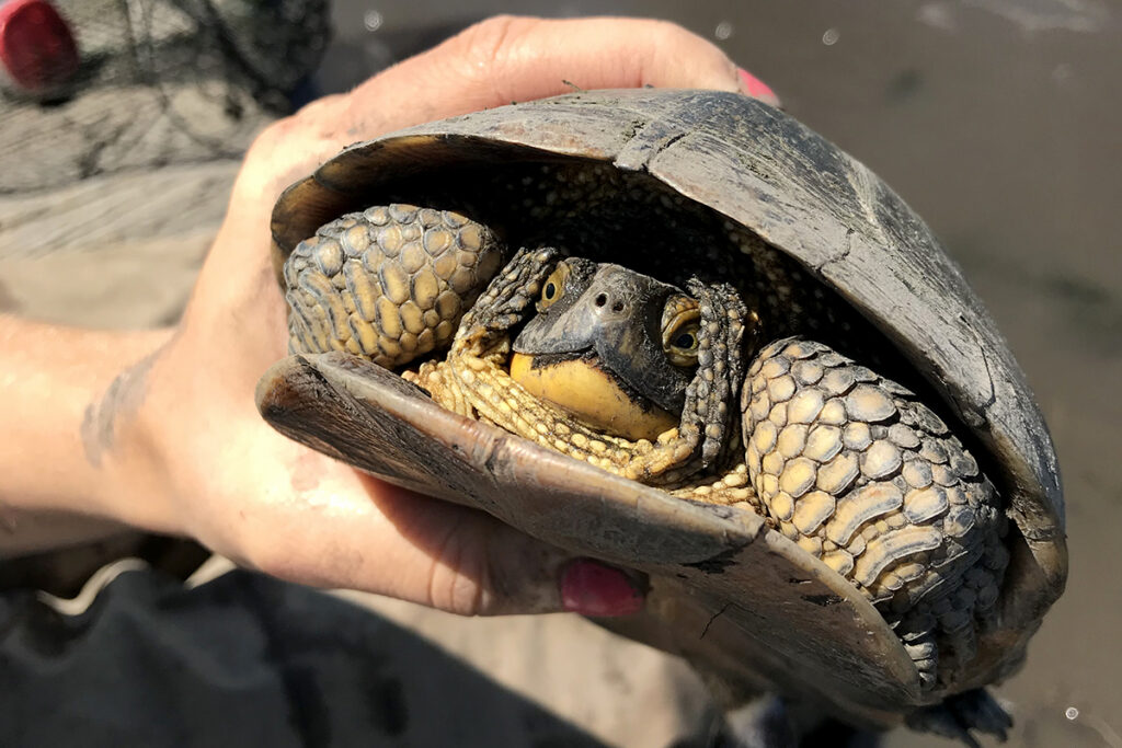
Blanding’s Turtle
Monitoring plants and animals along I-355
The I-355 extension, constructed in the mid-2000s, connects main arteries for travel and commerce in the Chicago area. From I-88 to I-80, a glance at a map will show how the road connected the south suburbs to other vital thoroughfares. Less obvious are the many natural areas the road spans.
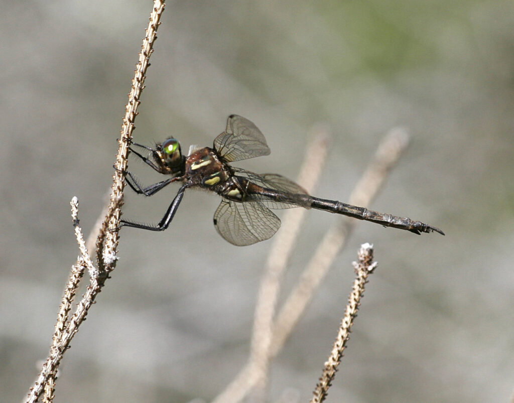
Those natural areas, including the Des Plaines River, are home to 29 listed species and five federally protected species. With 32 miles of road that serves 270,000 vehicles per day, both the construction and the road itself had the potential to negatively impact plants and animals that called the area home. In 2005, INHS and Illinois Tollway began their partnership, now called the Urban Biotic Assessment Program, monitoring the endangered Blanding’s Turtle and Hine’s Emerald Dragonfly thought to be in the path of the future I-355 extension. When researchers caught a Blanding’s Turtle in one of their traps, it meant there was important work ahead to protect the animals that could be impacted by the project.
INHS scientists like Dreslik and his lab conduct environmental assessments for transportation agencies across the state to monitor plants, animals, ecosystems, and habitats, as well as restoration, maintenance, and early detection of environmental threats. By working with the Illinois Tollway and the Illinois Department of Transportation, INHS helps those agencies avoid, minimize, or mitigate the impact of road projects across Illinois.
In the case of the I-355 extension, Dreslik explained, avoiding the turtles would not be possible, so they focused on taking steps to minimize and mitigate the impact on them. Dreslik’s team captured and tracked as many of the turtles as possible to monitor them and move them away from the construction zone if they ventured close. The Illinois Tollway also funded research on the turtles to mitigate habitat loss from the project.
“I-355, for example, has produced a lot of science,” Dreslik said, as numerous scientific papers, presentations and even student degrees came from the efforts. The work has now become a long-term longitudinal study of freshwater turtles in the middle Des Plaines River Valley: “We still go back and study the turtle populations there.”
The work INHS does helps the agency to stay in compliance and keep three schedules and budgets moving forward, avoiding the economic impacts of delays in infrastructure. INHS has a respected reputation and longstanding relationships with agencies. In addition to the Urban Biotic Assessment Program, INHS is home to the Biological Surveys and Assessment Program and the Wetland Science Program, which work with the Illinois Department of Transportation; the Critical Trends Assessment Program, which is supported by the Illinois Department of Natural Resources; and the Illinois Cooperative Agricultural Pest Survey Program, which works with the U.S. Department of Agriculture and the Illinois Department of Agriculture.
“We speak for the organism and their conservation,” Dreslik said. “We are going to do what is best for the species.”
Assessing water quality along I-294
Along sections of the Tri-State Tollway, Illinois State Geological Survey (ISGS) geologists have been monitoring the impacts of the road and the effectiveness of a type of green infrastructure that helps protect water quality for the people of Chicago and beyond.
Bioswales are a type of man-made wetland that help filter contaminants before the water makes its way from the road back to ponds, fishing lakes, urban streams and creeks, and groundwater in natural areas. Roadway contaminants include chloride from road salt, heavy metals from exhaust and from the degradation of tires and brakes, and suspended sediment, all of which can impact natural waterways and cause problems for the organisms that live in the water, explained Keith Carr, an ISGS wetlands geologist who works closely with Illinois Tollway. The ISGS Tollway Runoff Monitoring Program studies soil and water quality before, during, and after road construction projects, and provides data to Tollway on bioswale effectiveness, lifespan, and management and policy needs.
Chloride contamination from road salt is a significant concern in many places, but especially in the heavily traveled and snowy Chicago region. Monitoring is important for keeping areas in compliance with federal water quality standards set to protect the health of communities and ecosystems. Locally, contaminants like chloride that infiltrate groundwater that communities rely on for their water supply have negative impacts on the vital outdoor recreation opportunities accessible to people living in those areas. But Chicago’s location in the Great Lakes watershed and the Mississippi River watershed has even larger implications, with negative effects and positive effects added as the water moves downstream.
In addition to the work with Illinois Tollway through the Tollway Runoff Monitoring Program, ISGS assists the Illinois Department of Transportation through the Wetlands Geology section’s Statewide Hydrologic Survey Program. The scientific information produced under this partnership not only helps IDOT to comply with environmental regulations, but also increases the understanding of wetlands in Illinois.
Archaeological excavation and construction activities around the future Stan Musial Veterans Memorial Bridge.
Archaeological excavations along I-70
“What happens when you put a bridge through an ancient city?” For the New Mississippi River Bridge project in East St. Louis, it meant helping to unearth part of the ancient city of Cahokia, explained Tim Pauketat, Illinois State Archaeologist, director of the Illinois State Archaeology Survey and a senior research scientist at PRI.
Ahead of the bridge construction, archaeologists excavated a slice through the middle of a precinct of Cahokia in modern-day East St. Louis dating to A.D. 1000–1200, as well as the early Euro-American city of East St. Louis itself, dating from the 1800s to the early 1900s. Pauketat compared the excavation, one of the largest in North American history, to the classic, fictional Raiders of the Lost Ark. A large crew of around 50 had the monumental task of moving soil, identifying and mapping thousands of cultural deposits, and ultimately uncovering the remains of 1,500 ancient buildings.
Under the National Historic Preservation Act of 1966 and related state regulations, projects funded by state or federal money are required to protect history by identifying historic sites, identifying their potential significance and mitigating adverse effects of the planned project. ISAS has conducted hundreds of surveys and dozens of excavations each year for the Illinois Department of Transportation for more than 50 years, developing one of the most-renowned, award-winning transportation archaeology programs in the nation. The partnership makes it possible to preserve Illinois’ cultural heritage while efficiently addressing the state’s transportation needs.
ISAS additionally works with other agencies and conducts research outside of the compliance work ahead of transportation and other infrastructure projects, all of which contribute to a larger understanding of history and archaeology. ISAS has four field stations across the state and uses predictive models to try to understand where archaeological sites might be located in Illinois.
Sites can have historical significance for a specific group of people, such as Native American tribes or other local communities and ethnic groups. Sites can also be considered historically significant because they contribute to the understanding of a time period or because they are of cultural importance to the citizens of the United States. Determining historical significance is a collaborative process, that has been becoming more inclusive over time, Pauketat said. The new Mississippi River Bridge project marked one of the first times tribal involvement was incorporated, he added, something that has improved in the years since.
“Archaeology is the process of learning information about the past that is important to either the descendants or to all people,” Pauketat said, “because it’s important to understand history.”