Planning our Paths
Research and Monitoring Inform Statewide Land-use Decisions
It might be easy to take for granted that a road would not be built through an important historic site or the habitat of an imperiled species, that a developer would not invest in a building in danger from flooding, or that a nature preserve is safe from contamination because the land is protected. But none of that would be possible without expertise, data, and extensive mapping. Prairie Research Institute (PRI) scientists provide the resources needed to support sustainable land-use and natural resource planning and management activities across Illinois.
Land use choices have the potential to create negative impacts to adjacent areas—and to the people residing there and local ecosystems. Human activities that release chemicals or byproducts into the air, ground, or water can directly affect the nearby environment or cause contamination downstream. Road salt, septic systems, industrial activities, and agriculture feedlots and fertilizers are a few examples.
By monitoring water along infrastructure projects and in nature preserves, PRI has shed light on the impacts of adjacent land use. One long-term groundwater monitoring project by the Illinois State Geological Survey and the Illinois State Water Survey began at state-protected nature preserves a quarter-century ago in 1998. That effort has expanded over the years to include 414 nature preserves totaling 62,270 acres. The long-term data collection allows for early detection of watershed issues, drought indicators, and climate change, and is essential for habitat restoration.
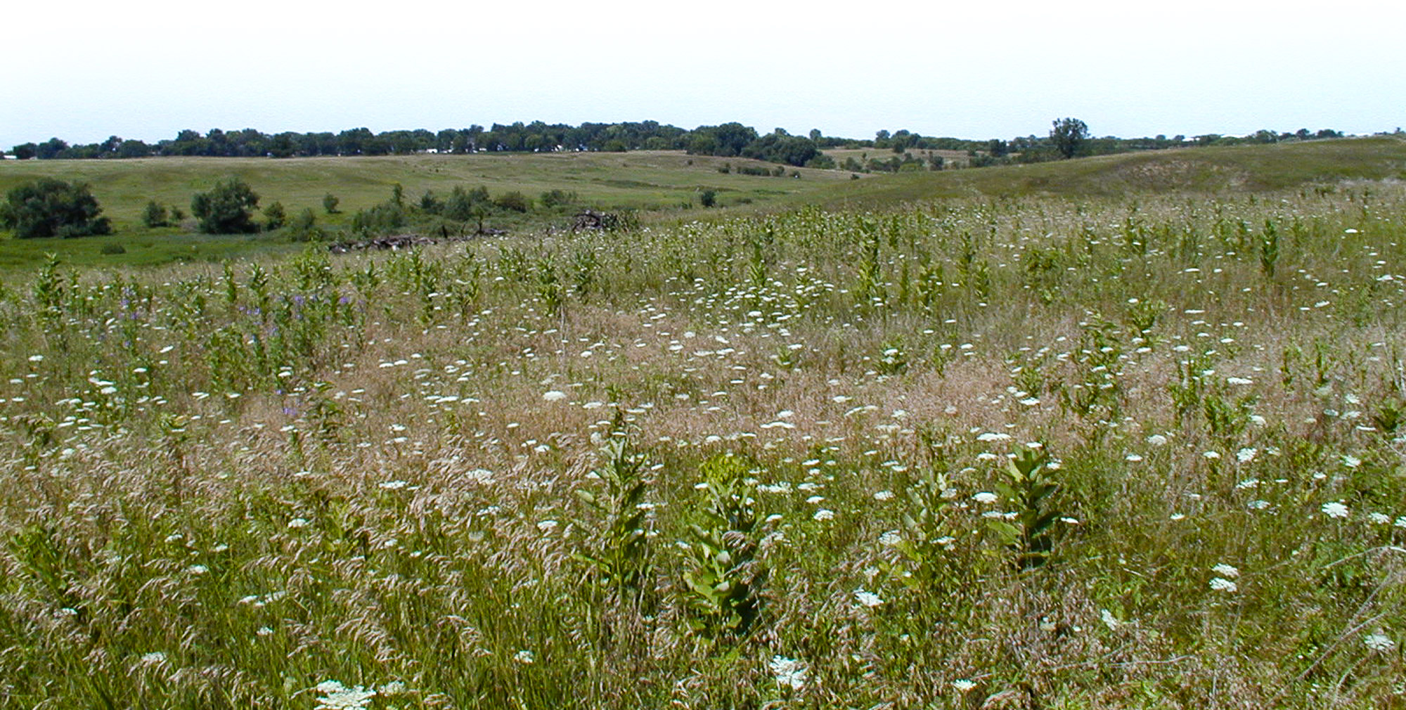
Lake in the Hills Fen Nature Preserve.
One land use that PRI scientists have studied in detail is coal combustion residuals, also called coal ash. Coal ash, a byproduct of burning coal, has been stored in surface impoundments and has implications for aquatic ecosystems and species, outdoor recreation, groundwater, and human health. After conducting a review of scientific knowledge about coal ash, researchers identified needed data and risk assessment, policy gaps, and state and federal funding needed to support the study and mitigation of coal ash in Illinois.
PRI’s work in monitoring and studying Illinois’ diverse ecosystems provides data and insights that are critical to decisions about endangered and threatened species, invasive species, and other conservation, restoration, and management activities, as well as the development of transportation infrastructure. PRI scientists have evaluated the climate change vulnerability for all 331 of Illinois’ threatened and endangered plant species. Other ongoing projects range from the latest—genetic and modeling techniques used to monitor and manage invasive carp—to the historic—building on 75 years of waterfowl species data needed for management, hunting, conservation planning, ecological research, and education.
PRI’s mapping work is essential for land use planning and management. Among these resources, PRI provides high-resolution digital elevation data for every Illinois county that is needed for planning by local, state, and federal agencies. By comparing this mapping data from different years, it’s possible to discern many land-use changes over time, thereby providing planners and developers with accurate measurements for assessing climate change effects on water and biota.
Snapshot of an ISWS flood model simulation showing how flood waters inundated North Park in Gibson City on August 12, 2021.
Mapping for hazard planning
The Illinois State Water Survey’s Coordinated Hazard Assessment and Mapping Program (CHAMP) conducts hydrologic and hydraulic modeling and mapping that helps communities prevent losses inflicted by Illinois’ most common weather-related natural disaster: flooding.
CHAMP staff conduct flood hazard studies and revisions for county Flood Insurance Rate Maps for the Federal Emergency Management Agency (FEMA) and offer outreach and assistance for communities with their expertise in digital mapping and data for natural hazard mitigation plans. CHAMP staff additionally work on research examining issues like the effects of urbanization, stormwater management, and climate change impacts.
Glenn Heistand is a research scientist, water resources engineer, and leads CHAMP, which he explained is FEMA’s Cooperating Technical Partner in Illinois. The Flood Insurance Rate Maps are important for identifying flood hazards, as well as for permitting and zoning for development. CHAMP also works with county and local governments to either update or create hazard mitigation plans, which include flooding as well as heat, earthquake, and other hazards. These plans must be updated every five years, are approved through FEMA, and are part of the system for a community to get recovery assistance from FEMA after a disaster.
The CHAMP team began their work with FEMA in 2004 as part of the agency’s Map-Modernization program, which later became the Risk Mapping Assessment and Planning program, but the future of their work will involve a new type of analysis as FEMA moves towards their Future Flood Risk Data initiative. Instead of just looking at rivers and streams, it will look at stormwater runoff – the water trying to get to the rivers and streams – and the floodplain concurrently. Heistand also said they will integrate probabilistic modeling that will allow for flood risk to be visualized and understood more accurately and will look at risk on a sliding scale, instead of a binary snapshot of risk.
“Right now, a property owner can look at the floodplain limit on a flood map and say, ‘Well, it’s 10 feet away from the corner of my house, therefore I’m safe.’ But that is not necessarily true; they are still at risk. They’re just not at risk in the binary version of risk that has been mapped in that snapshot,” Heistand explained. “We know that snapshot is changing and it is only a guide for a certain potential instance of flooding on the spectrum of risk that is possible over the lifetime of that structure.”
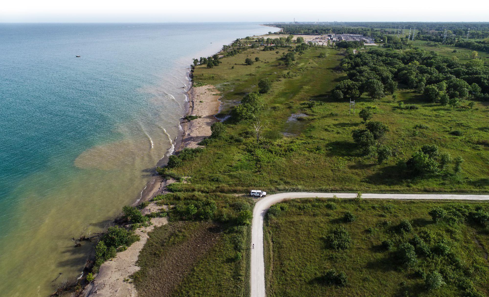
Lake Michigan shoreline. Image by Steve Brown, ISGS.
Mapping a dynamic shoreline
The Great Lakes, with more than 9,400 miles of shoreline, are home to one-fifth of the world’s fresh water and millions of people. While beachgoers enjoy Lake Michigan when the weather is nice, people sometimes forget how much remains unknown about the lake and just how violent it can be. Many lakefront areas in Illinois were inundated in 2020 and underwent substantial erosion when storm impacts along the coast were magnified by high lake-level conditions. Coupled with complex lake behaviors are poorly understood patterns of coastal sand transport, which factor into shoreline response to water-level changes.
“Lake Michigan is very energetic and the shoreline is a dynamic place,” Robin Mattheus, a coastal geology research scientist with the Illinois State Geological Survey, pointed out.
ISGS is home to extensive mapping resources.
Mattheus said PRI’s active geological monitoring program is something unique, with no analog elsewhere in the Great Lakes region. The ISGS team mapping Lake Michigan’s shoreline wants to know how it evolves in response to storms, changes in lake level, and winter ice-related processes. Such information, combined with climate change predictions for the region, can help coastal managers prepare for anticipated impacts along the coast. It takes knowing how shorelines respond to changing lake conditions to formulate a mitigation strategy.
“Mapping the lake bottom and shorelines often gives coastal managers and other stakeholder groups updated information that will help them make well-informed decisions on how to protect valuable coastal ecosystems, sand resources, and lakefront infrastructure,” Mattheus said. “The natural patterns of sand movement have been disrupted by urban lakefront expansion and other shoreline and offshore construction projects. This makes studying patterns of coastal change more challenging and reiterates the need for active geological monitoring.”
In addition to aerial imagery, which has always been an important tool for coastal researchers, the ISGS coastal crew also deploys sonar technologies that allow for detailed measurement of lake-bottom elevations. Together with data gathered from beach environments using drones, ISGS researchers render 3D models of Illinois beaches and nearshore regions. Comparing such models over time provides estimates of sand-volume changes. Drone technologies and high-resolution mapping have changed the way scientists are able to study the dynamic Lake Michigan coastline.
Illinois Beach State Park, North Unit.
Mapping to preserve cultural heritage
ISAS uses a number of tools, such as surveys, test excavations, aerial photography, lidar, and predictive modeling to help land managers, developers, and others avoid impacting cultural resources when making land-use decisions. Development is necessary, Lambert said, “but you can’t manage or protect a resource—whether it’s an archaeological site, an endangered species, or a wetland—without knowing where it is. That’s just a practical challenge and the data that we bring together builds on 100-plus years of archaeological work in the state.”
One specific tool ISAS uses to help promote sustainable development is the Illinois Archaeological Predictive Model. The predictive model combines existing archaeological site data with environmental data in modeling powered by machine learning to predict where sites might be located. This GIS-based tool helps development move forward with less impact on the archaeological record, preserving history and keeping it from “being destroyed by a bulldozer before anybody sees it.”
Slice of a map generated using the Illinois Archaeological Predictive Model.
By using spatial analysis, archaeologists can also look at gaps in what is known and unknown about the archaeological record of Illinois. ISAS is also beginning to look at extending modeling efforts to predict risk to archaeological sites in the future from factors like topsoil erosion, flooding, climate change, and changing patterns of development.
The predictive model and other models of potential impact on the archaeological record are not just tools for archaeologists, who can use them to focus their efforts and resources. The predictive model is publicly available, and Lambert said the team hopes for it to be widely used. It is useful for members of the public who are interested in helping protect Illinois’ archaeological record, as well as for the state historic preservation office when considering projects and reviewing proposed development.
“You could also think of it as a planning tool for developers,” Lambert said. “Maybe it could nudge them toward areas that would be better to build because they’re not going to impact as many sites, which leads to less mitigation, lower project costs, and more protection of our shared cultural heritage.”