Diving In
A Close-up Look at Illinois’ Water Resources
In the late 1800s, scientists at the Illinois State Water Survey (ISWS) were on a mission: trace the spread of waterborne diseases, especially typhoid, by studying the state’s water supplies. Using scientific investigation to find the cause of the deadly disease, they tested more than 21,000 water samples from 900 towns in all Illinois counties. This water monitoring initiative marked the beginning of the scientific study of water pollution in Illinois.
Although more than 125 years later typhoid is no longer a concern in the US, the study of water resources is still of upmost importance to our daily lives. ISWS scientists at the Prairie Research Institute (PRI) at the University of Illinois Urbana-Champaign are still on a mission to address societal problems concerning poor water quality, water shortages, and weather and climate-related natural disasters.
Ongoing research seeks to better understand natural and anthropogenic processes and to provide information to government, the agricultural industry, businesses, city and county planners, and Illinoisans. These activities reflect a continuing commitment to provide scientific information to help protect and preserve our water resources and to use them wisely.
Showcasing ISWS’ expertise and advancements
In its 125 years, ISWS has made significant advances in groundwater, surface water, and climate modeling; floodplain mapping; predictions on statewide water supplies and weather; among others. The Water Survey has earned its excellent reputation of providing evidence-based data and analyses for these reasons, according to Laura Keefer, Illinois State Hydrologist:
- Comprehensive Data Collection: The Water Survey collects thorough data and evidence to understand the complex dynamics of water systems.
- Dedicated Public Service: ISWS is not just a research body but also serves the public through health and environmental applications, hazard assessment, and mapping programs, and provides essential services such as water supply planning.
- Innovative Achievements: ISWS has been at the forefront of significant scientific milestones, such as the first US detection and photographing of a tornado by radar in 1953, showcasing its innovative spirit.
- Technical Guidance: The provision of technical guidance indicates the command over water-related issues and the ability to guide policy and practice.
- State Climatology Office: The office of the Illinois State Climatologist, housed within ISWS, acts as the state’s authoritative spokesperson on climate science, providing vital data and insights for various stakeholders.
- Interdisciplinary Approach: It operates across multiple scientific disciplines, offering a holistic approach to water and atmospheric resource management.
“Its long history of leadership in water resources, weather, and climate studies makes ISWS one of the oldest and most established institutions in its field,” Keefer said. “It has a strong tradition of collecting, analyzing, archiving, and disseminating high-quality, objective data and technical information, which provides a sound technical basis for decision making in Illinois.”
The breadth of activities at ISWS makes it unique among other institutions, including research, monitoring, outreach, services, training, and education. Scientists provide cutting-edge research, while addressing the needs of the state and providing stakeholders with unbiased, science-based information that is practical and understandable to decision-makers statewide. The following sections delve into ISWS activities on water quality and quantity, water-related hazards, and some services that ISWS provides.
View of Joliet, Illinois from Google Earth.
Novel models and tools for water supply planning
With climate change, new industrial development, and increasing populations in some areas, Illinois’ demand for water is projected to increase in the future. To provide adequate water supplies, the state needs information on how much water will be available, how much demand there will be in decades to come, and what are the options for increasing supplies and decreasing demand cost effectively.
Since 2006, ISWS has been leading water supply planning projects throughout the state in 10 regions and 1 subregion, funded by the Illinois Department of Natural Resources–Office of Water Resources (IDNR-OWR) along with a number of regional and local partners. In these projects, Water Survey scientists work with communities and regional stakeholders to identify issues and, in some cases, find alternative water supplies.
In one project, scientists have focused on northeastern Illinois where Chicago’s southern suburbs in Will, Kane, Kendall, and McHenry counties are at risk of having unsustainable water supplies as groundwater levels in the area have decreased because of long-term withdrawals.
Daniel Abrams, groundwater flow modeler at ISWS, described the conditions behind the aquifer’s depletion.
In his career at ISWS, Abrams and others built a groundwater model to simulate the region’s water usage based on data from the four counties, with model results matching data from the historic record.
Scientific analyses determined that the water levels would be unable to meet demand by 2030 in areas that have the highest risk. Following the study, communities in Will and Kendall counties developed alternative water supply plans.
Some cities, such as Joliet, are switching to Lake Michigan as the primary water source, yet this will not resolve the regional water shortage risk.
Made to order
The water supply models that scientists develop and use have become much more adaptable over time, providing answers in a localized area for a specific question using inputs on climate, local hydrology, aquifer specifications, and multiple other factors, said Cecilia Cullen, ISWS hydrogeologist.
“No matter the scale of study, it’s always going to be so complex,” Cullen said. “More data enables us to answer questions at a finer scale, regions to communities, communities to wells.”
With so many factors at play, there are always uncertainties. Yet, stakeholders want a timetable depicting when wells may no longer be productive.
“So many things can impact future water supplies: climate change, unexpected demands such as a new well being drilled, and increasing populations,” Cullen said. “Scientists are trained to communicate these uncertainties, but often the public wants definitive answers.”
To manage the uncertainties, the scientists use scenarios, such as current trend, less resource intensive, and more resource intensive, based on various assumptions of water availability and usage. Water Survey scientists have found that presenting scenarios and their impact on water supply is effective in addressing and communicating uncertainties.
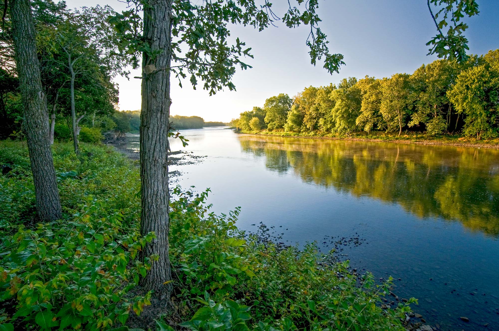
Kankakee River in northern Illinois.
Updated data and modern models
The advanced tools and techniques for water supply planning allow researchers to take newer factors into account when conducting water supply studies and developing recommendations. When Zhenxing Zhang, hydrologist, joined the Water Survey 10 years ago, climate change wasn’t routinely considered in the studies. Instead, they often used traditional methods, looking at how much water a community had and how much they had used historically. Today, climate change is critical in developing adequate plans.
“For us, we need to understand potential climate change and its impact to estimate water availability in a community or region,” Zhang said. “We need to know, if precipitation and temperature changes, what is the impact on the area’s hydrology?”
Zhang and colleagues developed a water supply planning framework that considers both future water demand and climate change impacts. When applied to the Kankakee River watershed, for which they developed six future water demand scenarios, they found that climate change appeared to have a greater impact on water availability than water demand in that region. The study was published in the Journal of the American Water Resources Association.
Part of strategic water supply planning is also preparing for drought. Conditions were very dry in the 1930s and 1950s, but drought has been less frequent in recent decades. In the future, however, drought could cause a serious strain on water availability and communities need to be prepared. Preparing for unsustainable water supplies takes a long-term view.
“Municipalities and industries need the heads up if they need to find an adequate water supply,” Zhang said. “It takes years to develop and implement new water supply projects.”
Resources
ISWS researchers have developed user-friendly, interactive maps to provide information about locations where they have conducted water supply planning. For maps, lists of publications, and other resources on each water supply planning region, click on each study area. In addition, this map indicates the level of risk to the supply for communities for each reservoir and lake in the state.
A few of the recent Water Survey publications include the following.
- ISWS Contract Report 2023-04, on groundwater models
- ISWS Contract Report 2022-02, current state of aquifer models in Chicago’s southwest suburbs
- ISWS Contract Report 2019-07, water supply planning in the Kankakee watershed
- ISWS Contract Report 2019-02, water demand in the Rock River water supply region
Microplastics floating in water.
Tracking migrating contaminants in groundwater
With concerns about natural and man-made contaminants found in groundwater from Illinois’ aquifers, for decades stakeholders at the local, state, and national levels have tasked PRI scientists with monitoring and studying chemicals in long-term and short-term projects. The researchers’ study results and expertise inform and advise decision-makers on the water quality of their underground water resources.
Findings have shown that concentrations of naturally occurring contaminants derived from minerals, such as arsenic and radium, are highly variable across the state, depending on the local aquifer conditions, according to Devin Mannix, hydrogeologist at ISWS. Lead from pipes can also be a concern for some using private well water. Man-made contaminants, such as microplastics, Per- and Polyfluorinated Substances (PFAS), nitrate from fertilizers, and chloride from winter deicers, are increasingly under investigation because of health concerns and ecosystem impacts. There is some good news, however.
“Thankfully, there’s been some encouraging trends with chloride from winter deicers,” Mannix said. “It’s early to say definitively, but in some locations, we’re seeing chloride concentrations starting to plateau. There’s a lot more visibility about the potential harm to ecosystems and water supplies; we’re hopeful sensible land use practices to reduce contaminant levels are taking off and starting to have an effect.”
PRI scientists have conducted numerous studies on contaminants in groundwater supplies, including the following projects.
Lead
Lead exposure can cause serious damage to children’s developing brains, so working with public health and homeowners to mitigate lead risk in water is vital. The U.S. Environmental Protection Agency (USEPA) has regulations concerning the maximum allowable limits for lead in community systems, but these regulations do not extend to water from private wells where users are responsible for their own water testing.
PRI scientists partnered with other universities and county health departments in 2019 to determine lead levels in homes with wells located in Jackson, Peoria, and Kane counties in Illinois. They found that 48% of sampled homes had measurable lead in their well water. Older homes were more likely to have detectable and elevated lead levels, especially older homes with corrosive groundwater. Water corrosivity varied in areas where higher-chloride winter deicers were used.
The study was published in 2021 in the Journal of Public Health Management and Practice. Researchers also developed a story map of their study methods and outcomes.
Chloride
The ongoing research on chloride from winter deicers has spanned decades and has resulted in more than 15 journal articles and numerous ISWS reports. In 2023, the ISWS Groundwater Section received the Salt Symposium Chloride Reduction Leadership Award, which recognizes individuals and groups that have made a significant contribution to chloride reduction.
The Groundwater Section conducts research to collect data and serves as the state’s repository of groundwater records and data. They also provide information to stakeholders and groups concerned about their groundwater quality.
As a result of increased awareness stemming from ISWS studies on chloride, some counties and municipalities are practicing sensible salting practices to help reduce chloride concentrations in groundwater.
Some of the significant reports and journal articles on chloride, as well as arsenic, nitrate, radium, and other contaminants include “Recent Trends in Chloride and Total Dissolved Solids in Silurian Wells in the Southwest Water Planning Group Region,” “Groundwater Quality within the Silurian Dolomite Aquifer in Will County, Illinois,” “Shallow Groundwater Sampling in Kane County, 2015,” and articles published in the Journal of the American Water Resources Association and in Abstracts with Programs – Geological Society of America.
Microplastics and PPCPs
Researchers at ISWS, Illinois State Geological Survey (ISGS), and the Illinois Sustainable Technology Center (ISTC) at PRI studied the occurrence of microplastics in groundwater in karst areas of northwestern and southwestern Illinois, which are particularly vulnerable to contamination from above-ground pollutants because of the aquifers’ unique geology.
Microplastics, mostly in fibers, were found in 16 out of 17 groundwater samples. The findings indicated that the microplastics were transported from the surface to deep aquifers from septic effluent. This was the first study of microplastics in karst groundwater systems in the nation. The research was published in the journal Groundwater.
In this and similar studies, a collaboration of PRI scientists found that pharmaceutical and personal care products (PPCPs) were also commonly found in karst aquifers. Eighty-nine percent of aquifers studied contained pharmaceuticals, according to a study in Science of the Total Environment from 2017. In a 2016 study, scientists sampled water from caves and springs in southwestern Illinois and found that PPCPs were prevalent in water samples, likely from sewage discharge and leaking sewage pipes.
Mannix and colleagues have developed an interactive shallow groundwater contamination vulnerability map that shows geologic layers to depict zones that have a higher risk of contaminants migrating into groundwater in sand and gravel aquifers.
Modeling watersheds to stem nutrient flow
Illinois is unique in that its watersheds are heavily developed with cropland and cities that highly influence the health of its rivers and streams. Excess nitrogen and phosphorus carried in runoff from city streets and farm fields or flowing from wastewater treatment plants can fuel algae blooms that decrease oxygen needed by aquatic plants and animals. Illinois’ nitrogen runoff into the Mississippi River is a large contributor to miles of dead zones in the Gulf of Mexico where aquatic life can’t survive. Excess nitrogen can also affect drinking water quality for local communities.
ISWS scientists monitor several watersheds across Illinois to help the state evaluate the effectiveness of the Conservation Reserve Enhancement Program (CREP), which aims to reduce the amount of nutrients and sediment entering Illinois’ rivers from agricultural lands. Over the years, scientists have undertaken several projects that focused on evaluating the impact of conservation practices in reducing non-point source (NPS) pollutants, said Elias Getahun, ISWS hydrologist.
To accomplish this, Getahun and colleagues created and employed a modeling framework that integrates a watershed simulation model with multi-objective evolutionary algorithms (MOEAs). The idea is to find alternative placements of agricultural best management practices within the watershed, based on which sound watershed management plans can be developed to reduce sediment and nutrient runoffs.
In Decatur, for example, 90% of the lake’s drainage area was used for agriculture, requiring an effective watershed management plan, Getahun said. The city of Decatur relied on ISWS scientists to monitor nitrates in the Upper Sangamon River watershed from the early 1990s to 2008. These data, along with PRI’s hydrologic and water quality modeling, were used to develop watershed management plans for two tributary subwatersheds of Lake Decatur that enabled the city to develop mitigation and watershed projects to treat and reduce nitrates.
In a study published in 2016 in the journal Sustainability of Water Quality and Ecology, Getahun developed a modeling system that identified best management conservation practices for nitrate reduction in the Lake Decatur watershed. Some of the practices included nutrient management at the farm level, constructed wetlands, and filter strips to improve water quality downstream.
Findings showed that nutrient management was the most preferable, with an annual nitrate loss reduction of 15% and cost savings in reducing the amount of nitrates used.
In a more recent study published in 2023, researchers studied the effectiveness of using winter cover crops to reduce nitrate pollution. The study showed that when used with all croplands on 75% of the watershed, a reduction in nitrate runoff of up to 24% was achieved.
Monitoring continues in the Kaskaskia watersheds, with funding from the Illinois Department of Natural Resources (IDNR).
Getahun and colleagues also developed an Illinois Coastal Zone Water Quality Database (ICoastalDB), funded by IDNR, and used it to determine and analyze more than 200 water quality parameters in the Illinois coastal zone. The data were collected from various agencies, programs, and projects and were compiled into the database with a final goal to determine the status of the water quality in that area. The three-phase project is ongoing and is now in its final phase.
ISWS Contract Report 2021-02, which describes phases 1 and 2, was published in December 2021. The database is in the Illinois Data Bank through the University of Illinois Library and has been downloaded over 100 times.
Among the recent publications for which Getahun is the lead author is ISWS Contract Report 2023-03, “Water Quality Trend Analysis for the Fox River Watershed: Stratton Dam to the Illinois River,” prepared for the Fox River Study Group.
Tracing the path of sediment
Excessive sediments are a water quality issue with both economic and environmental effects. Shipping lanes and reservoirs must be dredged periodically when sediment becomes too thick, and fish habitats can become unhealthy.
In the 1970s, state and federal agencies recognized that the loss of cropland soil productivity was caused by erosion and that a long-term statewide monitoring network was needed.
In 1981, ISWS initiated the ongoing Benchmark Sediment Monitoring Program to develop a long-term sediment network with samples taken weekly at 15 stations around the state.
Every week, a citizen observer from each of the 15 sediment monitoring network stations navigates bridges to take a water sample of suspended sediment, which is sediment that is floating in water between the surface and above the muddy current at the stream bottom.
Suspended sediment concentration data are used to compute sediment loads. This is done using streamflow data from U.S. Geological Survey gaging stations where ISWS Benchmark Sediment Monitoring Network stations are co-located. The greatest long-term sediment yields are mostly concentrated in the western portion of Illinois, along the Mississippi River.
Laura Keefer, State Hydrologist, believes that watershed land use and conservation programs that aim to slow erosion and sedimentation are having an effect. ISWS is performing further analysis to detect trends between years and seasons and combining information from other research databases.
In 2019, Keefer and coauthors published ISWS’ Report of Investigation 124, “Benchmark Sediment Monitoring Program for Illinois Streams: Analysis of 36 Years of Sediment Data.”
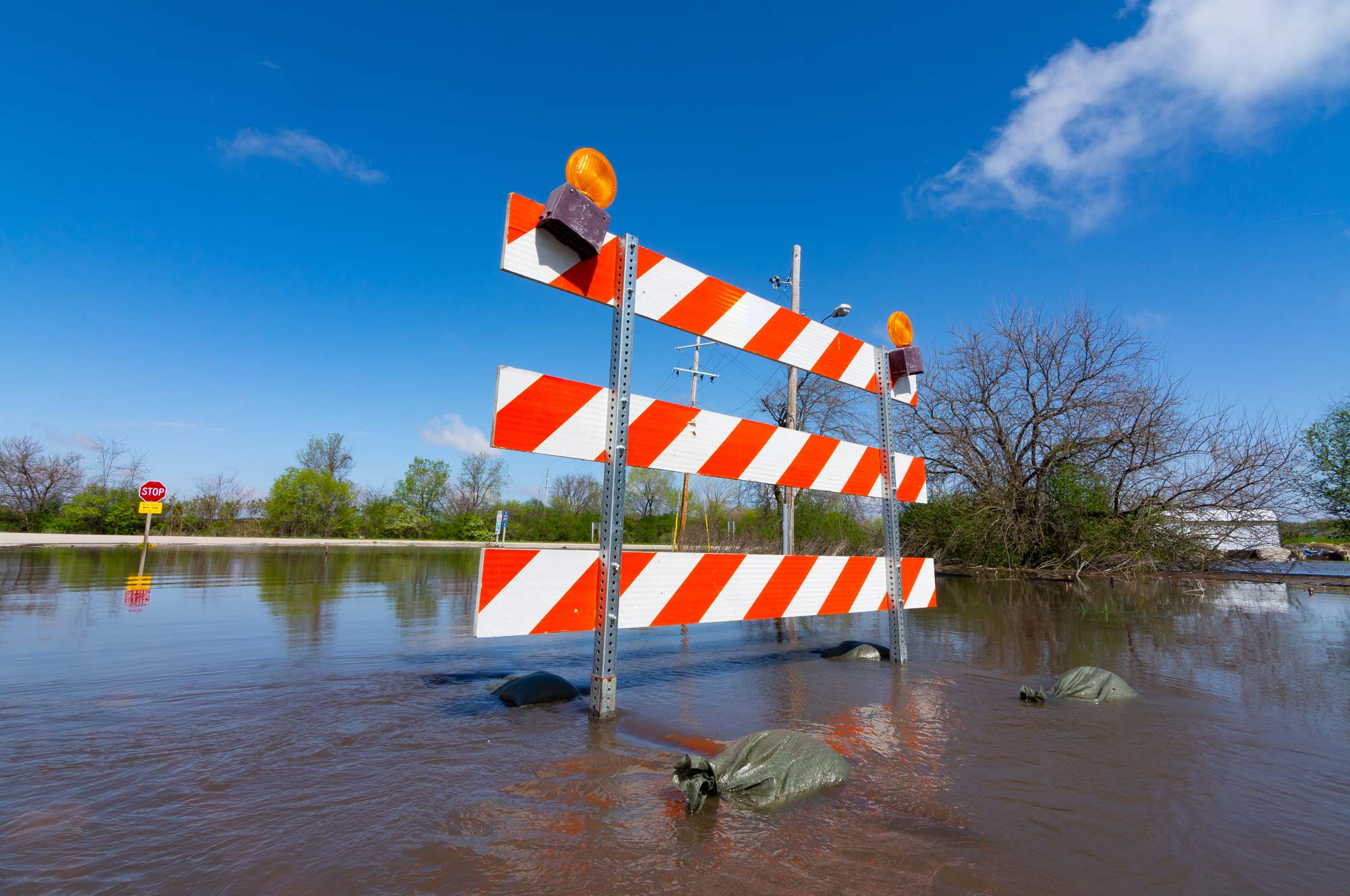
Mapping floods and fostering community resiliency
ISWS helps to mitigate the most common natural disaster in Illinois— flooding— by identifying flood hazards, assessing areas most at risk and partnering with communities to help them avoid future flood losses.
In the early 1970s, ISWS assumed the role of hydrology consultant to what is now the IDNR Office of Water Resources. To regulate floodplain development under a state floodway delineation program, ISWS experts conducted studies of streams, determined local flood elevations, and established a repository of floodplain information.
Decades later, in 2004, the Coordinated Hazard Assessment and Mapping Program (CHAMP) was initiated to work with the Federal Emergency Management Agency (FEMA) on updating regulatory flood hazard maps from paper format to digitized versions using GIS technology. Illinois was the second state to do so, behind Utah. IDNR has regulatory authority over flood issues, and CHAMP specialists work with IDNR on FEMA projects.
As a Cooperating Technical Partner (CTP) with FEMA, CHAMP also conducts field surveys and hydraulic and hydrologic studies of thousands of stream miles across the state to produce and update flood hazard data on the digital Flood Insurance Rate Maps (FIRM).
To date, CHAMP has produced or been funded to update FIRMs showing flood-prone areas in all but three Illinois counties. These maps show the areas that have a 1% chance of inundation in any given year. CHAMP engineers, GIS specialists, and urban planners continually reassess maps because of changes in land uses and climate and as new data become available. FEMA uses the maps to identify Special Flood Hazard Areas where flood permitting and insurance is required.
Among other CHAMP products available are the topographic wetness index that identifies low-lying areas that could hold excess water in storms. This information is particularly important because some areas are outside of FEMA’s mapped floodplains. The interactive map allows users to select an address and zoom in to locate low areas. Building footprints are the perimeter outline of structures created from digital aerial elevation maps to identify areas at high risk for flooding. The footprints are outlines of buildings with the size, shape, and location of their foundations.
Another critical aspect of flood mitigation is sharing information with community stakeholders and developing plans for greater community resiliency. In recent efforts, staff helped communities with official FEMA-approved hazard mitigation plans for floods and other natural hazards. These plans are required to receive certain federal disaster relief funds, but they expire every five years and must be updated and re-approved.
Keeping an eye on droughts
Too little precipitation can cause droughts, which are complex events with widespread impacts. It’s difficult to know when a drought begins and ends and can be defined mostly by its effects, such as agricultural crop losses, water shortages, and low water levels in rivers and streams. Drought in Illinois typically affects plants and crops first as water is depleted from the soil, and then water resources.
When drought conditions start to emerge in the state, Illinois State Climatologist Trent Ford is already tracking it. He leads the state’s monitoring team, including National Weather Service offices, Extension, federal and state agencies, and academics. This team assesses conditions and provides weekly recommendations to the US Drought Monitor.
Tools used for drought monitoring are always changing and improving with better computing resources and a greater understanding of drought and its impacts. Soil moisture has been an aspect of drought monitoring that was lacking. Over the past 15 years, however, soil moisture monitoring has expanded through in-ground sensors, satellites, and computer models.
Impact assessment is another area that needs improvement. Often underreported, impacts on agriculture, hydrology, water resources, and other factors are the “ultimate confirmation of a drought” and are vital for drought monitoring. Ford hopes that, as drought monitoring and assessment continue to improve, drought research can link the complexity and predictability of drought to the sometimes subtle impacts we experience.
Flash droughts are not a new phenomenon, but new drought monitoring tools are better able to be attuned to the fast onset of dry conditions and intensifying impacts. In the past few years, scientists have begun examining flash droughts to learn more about the climatic, atmospheric, and environmental conditions that affect them.
“Drought is incredibly complex because it is a hazard mostly defined by the various impacts it causes,” Ford said. “But those impacts can be challenging to define, identify, and predict. It’s crucial that scientists like me are communicating with and listening to practitioners and stakeholders in every sector to deliver the most relevant and actionable information and services related to drought.”
Providing services for science and public outreach
Alongside its academic endeavors, the Water Survey provides services for Illinoisans, organizations, and agencies concerned about water quality.
Although private wells are the primary water source for 15% of the US population, a majority of well owners don’t know how to care for their wells or determine if their water is safe. The national Private Well Class program provides online and in-person webinars and training to educate private well owners, contractors, real estate specialists, and water well professionals. The program is supported by the Rural Community Assistance Partnership (RCAP) and USEPA.
The WaterOperator.org site is a compilation of the best resources online for small water system operators. This free hub indexes more than 11,000 training events annually and over 17,000 resources.
The Health & Environmental Applications Laboratory (HEAL) conducts water analysis for University of Illinois researchers. Measurements include metals, nutrients, and other inorganic parameters for projects on groundwater quality, watershed monitoring, well contamination, atmospheric deposition, and lake quality. Analyses support a better understanding of our water resources.
As part of the Water and Atmospheric Resources Monitoring (WARM) Program, the Illinois Climate Network stations across the state collect data on wind speed, temperature, humidity, precipitation, and barometric pressure at 5-minute intervals and soil temperature and moisture at hourly intervals. The agriculture industry and national organizations use the data for research, long-term planning, and program support.